Monday 24 June 2019

Diyarbakır Fortress and Hevsel Gardens Cultural Landscape

Diyarbakır is surrounded by an almost intact set of high walls of black basalt around the old city. There are four gates into the old city and 82 watch-towers on the walls.

Diyarbakır Fortress
This postcard was sent by Muammer

The Diyarbakır Fortress and Hevsel Gardens Cultural Landscape is located on an escarpment in the Upper Tigris River Basin. The fortified city with its associated landscape has been an important centre and regional capital during the Hellenistic, Roman, Sassanid and Byzantine periods, through the Islamic and Ottoman periods to the present. The property includes the impressive Diyarbakır City Walls of 5800 metres – with its many towers, gates, buttresses and 63 inscriptions from different historical periods; and the fertile Hevsel Gardens that link the city with the Tigris River and supplied the city with food and water. The City Walls, and the evidence of their damage, repair and reinforcement since the Roman period, present a powerful physical and visual testimony of the many periods of the region’s history. The attributes of this property include the İçkale (Inner Castle), Diyarbakır City Walls (known as the Dişkale or Outer Castle), including its towers, gates and inscriptions, the Hevsel Gardens, the Tigris River and Valley, and the Ten-Eyed Bridge. The ability to view the walls within their urban and landscape settings is significant, as are the hydrological and natural resources that support the functional and visual qualities of the property. - inhttps://whc.unesco.org/en/list/1488

Parthian Fortresses of Nisa

Nisa was a major trading hub in the Parthian Empire.

Old Nisa
This postcard was sent from Germany by Claus

The Parthian Fortresses of Nisa consist of two tells of Old and New Nisa, indicating the site of one of the earliest and most important cities of the Parthian Empire, a major power from the mid 3rd century BC to the 3rd century AD. They conserve the unexcavated remains of an ancient civilization which skilfully combined its own traditional cultural elements with those of the Hellenistic and Roman west. Archaeological excavations in two parts of the site have revealed richly decorated architecture, illustrative of domestic, state and religious functions. Situated at the crossroads of important commercial and strategic axes, this powerful empire formed a barrier to Roman expansion while serving as an important communication and trading centre between east and west, north and south. - in: https://whc.unesco.org/en/list/1242/

Wednesday 12 June 2019

Medina of Tunis

The guided tour to Carthage also included a visit to the Bardo Museum, to Sidi Bou Said and to the Medina of Tunis. Once again, to see everything in the Medina the best way is to go on your own, but is quite possible to get lost. It's huge and crowded. I was slightly disappointed because we barely saw the Zitouna Mosque. But the biggest disappointment was 14 postcards out of 20 that I sent and did not reach the destination yet. Maybe they still arrive but I'm losing hope...

Medina of Tunis

The Medina of Tunis is the Medina quarter of Tunis, capital of Tunisia
The Medina contains some 700 monuments, including palacesmosquesmausoleumsmadrasas and fountains dating from the Almohad and the Hafsid periods.
Founded in 698 around the original core of the Zitouna Mosque, the Medina of Tunis developed throughout the Middle Ages. The main axis was between the mosque and the centre of government to the west in the kasbah. To the east this same main road extended to the Bab el Bhar. Expansions to the north and south divided the main Medina into two suburbs north (Bab Souika) and south (Bab El Jazira). - in: wikipedia

Mosque of El-Zituna

Ez-Zitouna Mosque or Ezzitouna Mosque or Mosque of El-Zituna (literally meaning the Mosque of Olive) is a major mosque in TunisTunisia.
The mosque is the oldest in the Capital of Tunisia and covers an area of 5,000 square metres (1.2 acres) with nine entrances. It has 160 authentic columns brought originally from the ruins of the old city of Carthage. The mosque is known to host one of the first and greatest universities in the history of Islam.
Ez-Zituna was the second mosque to be built in Ifriqiya and the Maghreb region after the Mosque of Uqba in Kairouan. The exact date of building varies according to source. - in: wikipedia


Porte de France

Bab el Bhar ("the sea gate"), also known as Porte De France (the gate of France), is a city gate in Tunis, the capital of Tunisia. It marks the separation between the Medina of Tunis and the European city. The gate is made up of a lowered archway and topped by a crenellated parapet. - in: wikipedia

Monday 10 June 2019

Archaeological Site of Carthage

We went on a guided tour to Carthage but we only visit a part of the archaeological site: the Baths of Antoninus. To visit everything the best way is to go on your own. Nevertheless, it was very worth it

Carthage
This postcard was sent by Jason

Founded by the Phoenicians, Carthage is an extensive archaeological site, located on a hill dominating the Gulf of Tunis and the surrounding plain.  Metropolis of Punic civilization in Africa and capital of the province of Africa in Roman times, Carthage has played a central role in Antiquity as a great commercial empire. During the lengthy Punic wars, Carthage occupied the territories that belonged to Rome, which then destroyed its rival in 146 AD.  The town was rebuilt by the Romans on the ruins of the ancient city.
The property comprises the vestiges of Punic, Roman, Vandal, Paleochristian and Arab presence. The major known components of the site of Carthage are the acropolis of Byrsa, the Punic ports, the Punic tophet, the necropolises, theatre, amphitheatre, circus, residential area, basilicas, the Antonin baths, Malaga cisterns and the archaeological reserve. - in: http://whc.unesco.org/en/list/37

Baths of Antoninus

The Baths of Antoninus or Baths of Carthage, located in CarthageTunisia, are the vastest set of Roman Thermae built on the African continent and one of three largest built in the Roman Empire. The baths are also the only remaining Thermae of Carthage that dates back to the Roman Empire's era. The baths were built during the reign of Roman Emperor Antoninus Pius.

Baths of Antoninus

The baths are at the South-East of the archaeological site, near the presidential Carthage Palace. The archaeological excavations started during the Second World War and concluded by the creation of an archaeological park for the monument. It is also one of the most important landmarks of Tunisia. - in: wikipedia

Rotunda of Damous El Karita Basilica

The basilica of Damous El Karita is a Tunisian basilica, located in Carthage, dating from the Late antiquity and the Byzantine epoch. It is situated nearby the Odeon hills within the archeological site of Carthage.
Most important and known Christian architectural complex within the capital of the Roman province of Africa, it is according to Noël Duval"one of the most important Christian monuments" but also "most abused and poorly known". The architectural complex, indeed was one of the most important architectural Christian cultural ensembles of North Africa from the late antiquity up to the late middle-ages. The entire ensemble was composed of 2 churches, at least one martyrium, several Hypogeums as well as a subterran rotunda with a complex interpretation. - in: wikipedia

Tophet

The burial site at Carthage in Tunisia, as well as others in the region, was discovered in the 20th century. It, along with the others, contained funerary urns stuffed with the cremated ashes and bone fragments of young children. Over 20,000 urns buried under stelae (stone slabs with inscriptions) were found at the tophet in Carthage, which is one of the largest cemeteries from the Phoenician period. - in: https://www.atlasobscura.com/places/tophet-at-carthage

Saturday 8 June 2019

Punic Town of Kerkuane and its Necropolis

We didn't visit this site but luckily I found postcards in the hotel where we stayed 

Punic Town of Kerkuane


Kerkouane or Kerkuane is the site of an ancient Punic city in north-eastern Tunisia, near Cape Bon. This Phoenician city was probably abandoned during the First Punic War (c. 250 BCE) and, as a result, was not rebuilt by the Romans. It had existed for almost 400 years.
Excavations of the town have revealed ruins and coins from the 4th and 3rd centuries BCE. Around the site where the layout is clearly visible, many houses still show their walls, and the coloured clay on the facades is often still visible. The houses were built to a standard plan, in accordance with a sophisticated notion of town planning.
A sanctuary has some columns preserved, and in a small atrium parts of mosaics are found. Curbstones, doorsteps, thresholds, and floors of simple mosaic layers are found all over the ruins. - in: wikipedia

Kairouan

Kairouan was the second UNESCO site we visited in Tunisia. It wasn't in my initial plans but I'm glad we did it because it was the highest point of the trip. Just for the Great Mosque is already worth it, but there's more to see.

Kairouan
Kairouan, also spelled Kairwan, is the capital of the Kairouan Governorate in TunisiaThe city was founded by the Umayyads around 670. In the period of Caliph Mu'awiya (reigned 661–680), it became an important centre for Sunni Islamic scholarship and Quranic learning, and thus attracting a large number of Muslims from various parts of the world, next only to Mecca and Medina. - in: wikipedia

Mosque of Uqba

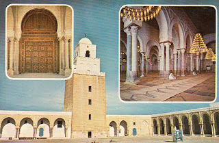
The Great Mosque of Kairouan, also known as the Mosque of Uqba, is a mosque situated in the UNESCO World Heritage town of KairouanTunisia.
Established by the Arab general Uqba ibn Nafi in 670 (the year 50 according to the Islamic calendar) at the founding of the city of Kairouan, the mosque is spread over a surface area of 9,000 square metres and it is one of the oldest places of worship in the Islamic world, as well as a model for all later mosques in the Maghreb. The Great Mosque of Kairouan is one of the most impressive and largest Islamic monuments in North Africa; its perimeter is almost equal to 405 metres (1,328 feet). This space contains a hypostyle prayer hall, a marble-paved courtyard and a square minaret. In addition to its spiritual prestige, the Mosque of Uqba is one of the masterpieces of Islamic architecture, notable among other things for the first Islamic use of the horseshoe arch.

Mosque of Uqba

The minaret, which occupies the centre of the northern façade of the complex's enclosure, is 31.5 metres tall and is seated on a square base of 10.7 metres on each side. It is located inside the enclosure and does not have direct access from the outside. It consists of three tapering levels, the last of which is topped with a small ribbed dome that was most probably built later than the rest of the tower.] The first and second stories are surmounted by rounded merlons which are pierced by arrowslits. The minaret served as a watchtower, as well as to call the faithful to prayer.

Mosque of Uqba
This postcard was sent from Finland by Heidi

The prayer hall is located on the southern side of the courtyard; and is accessed by 17 carved wooden doors. A portico with double row of arches precede the spacious prayer hall, which takes the shape of a rectangle of 70.6 metres in width and 37.5 metres' depth.
The central nave, a sort of triumphal alley which leads to the mihrab, is significantly higher and wider than the other sixteen aisles of the prayer hall.
Enlightened by impressive chandeliers which are applied in countless small glass lamps, the nave opens into the south portico of the courtyard by a monumental delicately carved wooden door, made in 1828 under the reign of the Husainids. - in: wikipedia

Mosque of the Barber

The Mausoleum of Sidi Sahab, generally known as the Mosque of the Barber, is actually a zaouia located inside the city walls. It was built by the Muradid Hammuda Pasha Bey (mausoleum, dome and court) and Murad II Bey (minaret and madrasa). In its present state, the monument dates from the 17th century.
The mosque is a veneration place for Abu Zama' al-Balaui, a companion of the prophet Muhammad, who, according to a legend, had saved for himself three hairs of Muhammad's beard, hence the edifice's name. The sepulchre place is accessed from a cloister-like court with richly decorated ceramics and stuccoes. - in: wikipedia

Aghlabid Bassins

The hydraulic ensemble, built in the 9th century by the Aghlabid Dynasty, has provided water for townspeople in Kairouan for more than a millennium. The Aghlabid Basins are composed of two connected cisterns which together form an open-air reservoir, fed by a 36-mile aqueduct that sources water from the hills beyond town. Water flowed into the smaller pool, which serves as a sort of filter, collecting stray sediments before the water is transferred to the larger basin, which is an impressive 16 feet deep and 420 feet in diameter.
The basins would fill up with rainwater, which would be used for washing or for emergency hydration, though contamination always posed a major risk. Still, the system is remarkably sophisticated engineering feat for its time, and considered the largest hydraulic installation of the Middle Ages. - in: https://www.atlasobscura.com/places/aghlabid-basins

Friday 7 June 2019

Amphitheatre of El Jem

Last April my family and I visited for the first time a non-European country. We spent one week in Tunisia and during the stay we visited 4 UNESCO sites of the country. The Amphitheatre of El Jem was the first. It's an amazing building and very well conserved. We just didn't understand why the guide told us that the movie "Gladiator" was filmed here. When we return we found out that wasn't true...

Amphitheatre of El Jem


Amphitheatre of El Jem is an oval amphitheatre in the modern-day city of El DjemTunisia, formerly Thysdrus in the Roman province of Africa.

Amphitheatre of El Jem


The amphitheatre was built around 238 AD in Thysdrus, located in the Roman province of Africa Proconsularis in present-day El Djem, Tunisia. It is one of the best preserved Roman stone ruins in the world, and is unique in Africa. As other amphitheatres in the Roman Empire, it was built for spectator events, and it is one of the biggest amphitheatres in the world. The estimated capacity is 35,000, and the sizes of the big and the small axes are respectively 148 metres (486 ft) and 122 metres (400 ft). The amphitheatre is built of stone blocks, located on a flat ground, and is exceptionally well conserved. The amphitheatre of El Jem is the third amphitheatre built on the same place. The belief is that it was constructed by the local proconsul Gordian, who became the emperor as Gordian III. In the Middle Ages, it served as a fortress, and the population sought shelter here during the attacks of Vandals in 430 and Arabs in 647. In 1695, during the Revolutions of TunisMohamed Bey El Mouradi made an opening in one of the walls to stop the resistance of the followers of his brother Ali Bey al-Muradi who gathered inside the amphitheater. - in: wikipedia

Early Christian Necropolis of Pécs (Sopianae)

I received this postcard this week and with it I completed Hungary, at least until new inscriptions

Roman Cemetery - Pécs
This postcard was sent by Svenja

The city of Pécs was founded by the Romans in the second century. By the fourth century, the city – known then as Sopianae – became a prosperous provincial capital and one of the most significant centers of early Christianity. The cemetery’s history can be traced back to the first century; this was the period when, thanks to its northern expansion, the Roman Empire reached today’s Transdanubia, and established the province of Pannonia.
The Paleo-Christian necropolis of Pécs is regarded as one of the most significant Roman provincial cemeteries. Both its architecture and incredible mural paintings are regarded as some of the most outstanding accomplishments in Europe. The cemetery’s significance is present not only in the fact that we can get an insight into the Roman Empire’s northern and western provinces’ architecture, art and burial habits, but also in its countless burial structures: brick tombs, burial structures made of stone, chapels and crypts. - in: https://hungarytoday.hu/the-early-christian-necropolis-of-pecs/

Wednesday 5 June 2019

El Pinacate and Gran Desierto de Altar Biosphere Reserve

This is a UNESCO World Heritage site and a UNESCO Biosphere Reserve

Crater Cerro Colorado
This postcard was sent by Javier

El Pinacate and Gran Desierto de Altar Biosphere Reserve is located in the Sonoran Desert. (...) It is a large and relatively undisturbed protected area which comprises two very distinct broad landscape types. To the East, there is a dormant volcanic area of around 200,000 ha, comprised of the Pinacate Shield with extensive black and red lava flows and desert pavement. The volcanic shield boasts a wide array of volcanic phenomena and geological formations, including a small shield-type volcano. The most visually striking feature is the concentration of a total of 10 enormous, deep and almost perfectly circular Maar (steam blast) craters.

El Pinacate and Gran Desierto de Altar
This postcard was sent by Marco

In the West towards the Colorado River Delta and South towards the Gulf of California, is the Gran Altar Desert, North America's largest field of active sand dunes and only active Erg dunes. The dunes can reach 200 meters in height and contain a variety of dunes types. The dunes originate from sediments from the nearby Colorado Delta and local sources. In addition, there are several arid granite massifs emerging like islands from the sandy desert flats, ranging between 300 and 650 m.a.s.l., which represent another remarkable landscape feature harbouring distinct plant and wildlife communities. - in: https://whc.unesco.org/en/list/1410

Monday 3 June 2019

Pre-Hispanic Town of Uxmal

This is another site of the Maya culture that I would love to visit

Uxmal is an ancient Maya city of the classical period in present-day Mexico. It is considered one of the most important archaeological sites of Maya culture, along with PalenqueChichén, and Calakmul in Mexico, Caraco land Xunantunich in Belize, and Tikal in Guatemala.


Pyramid of the Magician, Uxmal
This postcard was sent by Jason

The Pyramid of the Magician (SpanishPirámide del adivino, "pyramid of the foreteller") is a Mesoamerican step pyramid located in the ancient Pre-Columbian city of UxmalMexicoThe pyramid is the tallest and most recognizable structure in Uxmal.
The exact height of the Pyramid of the Magician is in dispute and has been reported as tall as 40 metres (131 feet) and as low as 27.6 metres (90.5 feet). The accepted median height is 35 metres (115 feet), with the base measuring approximately 69 by 49 metres (227 by 162 feet). Despite the absence of an exact measurement, the pyramid remains the tallest structure at Uxmal.
The Pyramid of the Magician is the most distinctive Mayan structure on the Yucatán Peninsula. The pyramid is considered unique because of its rounded sides, considerable height, steep slope, and unusual elliptical base. - in: wikipedia

Nunnery Quadrangle, Uxmal
This postcard was sent by Marco

The Nunnery Quadrangle (a nickname given to it by the Spanish; it was a government palace) is the finest of Uxmal's several fine quadrangles of long buildings. It has elaborately carved façades on both the inside and outside faces. - in: wikipedia

Sunday 2 June 2019

Classical Weimar

Classical Weimar consists of multiple structures related to Weimar Classicism. Goethe and Schiller were two of the personalities that most contributed to that movement. 


Goethe's House
This postcard was sent by Hanko


The Goethe House (Goethes Wohnhaus) is the main house lived in by the writer, poet, and statesman Johann Wolfgang von Goethe whilst in Weimar, Germany, though he did live in several others in the town. The home serves as the main location of the Goethe-Nationalmuseum.
In Goethe's residential building, situated at the Weimar place "Frauenplan", visitors can view the rooms in which he and his wife, Christiane Vulpius, lived, at Goethe's study and library, the reception room, the rooms where the art collection was stored, and the garden. The house also contains research facilities, including the “Studiensaal”, an institution used during the age of Goethe which is similar to a congress or conference centre today. - in: wikipedia

Schiller's House
This postcard was sent by Javier

The Schiller family lived here from 1802 until the death of Charlotte von Schiller in 1826. As the first memorial to a poet open to the public in Germany, the house opened its doors as early as 1847. Today the house presents a vivid impression of the tastes of the time and the everyday life of the Schiller family, with its many authentic exhibits, such as a coffee pot made of Thuringian porcelain. One major attraction is the study with its largely original furnishings. It was here that the poet completed his plays "The Bride of Messina" and "William Tell". - in: https://www.visit-thuringia.com/travel-hotel-holiday-tour/schillers-wohnhaus-103732.html

Duchess Anna Amalia Library
This postcard was sent by Hanko

The Duchess Anna Amalia Library (German: Herzogin Anna Amalia Bibliothek) in Weimar, Thuringia, Germany, houses a major collection of German literature and historical documents.
The research library today has approximately 850,000 volumes with collection emphasis on the German literature. Among its special collections is an important Shakespeare collection of approximately 10,000 volumes, as well as a 16th-century Bible connected to Martin Luther.
The Duchess Anna Amalia Library is named for Anna Amalia, Duchess of Saxe-Weimar-Eisenach, who arranged in 1766 for the courtly (hoefische) book collection to be moved into the library. - in: wikipedia

Russian Orthodox Chapel
This postcard was sent by Hanko

The Russian Orthodox Chapel is a funerary chapel built in Weimar in 1860 for Grand Duchess Maria Pavlovna of Russia. It was constructed in the Historical Cemetery behind the Weimarer Fürstengruft, to which it is connected by an underground passage. Maria Pavlovna's coffin is located in the passage, with her husband Charles Frederick's coffin placed directly beside it. A spiral staircase leads to another underground connection to the Fürstengruft, though this is now closed by a metal plate. - in: wikipedia

Goethe's Garden House on the Ilm
This postcard was sent by Austin

The former vineyard cottage in the Park on the Ilm, probably built around the end of the 16th century, was the first home acquired by Johann Wolfgang Goethe in Weimar in 1776, a few months after his arrival in Weimar, together with the surrounding garden. The purchase was financed by Duke Carl August of Saxe-Weimar-Eisenach. The Gartenhaus was Goethe’s main residence and workplace until he moved to Frauenplan in June 1782. He worked for the Privy Council, the Duchy’s highest governing authority, and performed other offices entrusted to him from there. A large part of his literary works dated back to that period were also written there, including the ballad of the Erlkönig and the poem To the Moon. - in: https://www.klassik-stiftung.de/en/institutions/museums/goethe-gartenhaus/


Schloss Belvedere
This postcard was sent by Ina

The Baroque Schloss Belvedere, Weimar on the outskirts of Weimar, is a pleasure-house (Lustschloss) built for house-parties, built in 1724-1732 to designs of Johann August Richter and Gottfried Heinrich Krohne for Ernst August, Duke of Saxe-Weimar. The corps de logis is flanked by symmetrical pavilions. Today it houses part of the art collections of Weimar, with porcelains and faience, furniture and paintings of the eighteenth century.
As the summer residence, its gardens, laid out in the French style in 1728-1748, were an essential amenity. A wing of the Orangery in the Schlosspark contains a collection of historical carriages.
After 1811, much of the outer gardens was altered to conform to the English landscape garden style, as an Englischer Garten, for Grand Duke Carl Friedrich, who died at Belvedere in 1853. The enriched collection of exotic plants was published as Hortus Belvedereanus in 1820. - in: wikipedia

Castle and Castle Park Tiefurt
This postcard was sent by Hanko

Built in 1765 as a tenement house for a grand ducal demesne, the building served from 1776 as the residence of Prince Friedrich Ferdinand Constantin, the younger brother of the reigning Duke Carl August of Saxe-Weimar-Eisenach. After the expansion of the tenement house to a country mansion, he and his tutor Karl Ludwig von Knebel designed a landscaped park in English style. Meandering paths were laid together with the first park architecture and seating, and various types of plants were cultivated. After Constantin’s departure to Weimar in 1781, Duchess Anna Amalia moved her summer residence to Tiefurt and continued to develop the park step by step. - in: https://www.klassik-stiftung.de/en/institutions/castles-and-gardens/tiefurt-mansion-and-park/


Ettersburg Castle
This postcard was sent by Hanko


Ettersburg Castle lies on the edge of the forest on the northern side of the Grosse Ettersberg. This woodland has been the hunting ground for the Dukes of Weimar since the 17th century. Duke Wilhelm Ernst started building the castle at the beginning of the 18th century; the work was completed by his nephew Ernst August. - in: https://www.klassik-stiftung.de/en/institutions/castles-and-gardens/ettersburg-castle-and-park/

Buildings that are included in this site (in red what I have):
  • Goethe's House
  • Schiller's House
  • City Church, Herder House and the Old High School
  • City Castle
  • Widow's Palace
  • Duchess Anna Amalia Library
  • Princes' Tomb and Historic Cemetery
  • Park on the Ilm with Roman House, Goethe's Garden House and Garden
  • Castle, Orangery and Castle Park Belvedere
  • Castle and Castle Park Tiefurt
  • Castle and Castle Park Ettersburg