Showing posts with label Netherlands. Show all posts

Sunday, 31 October 2021

Van Nellefabriek

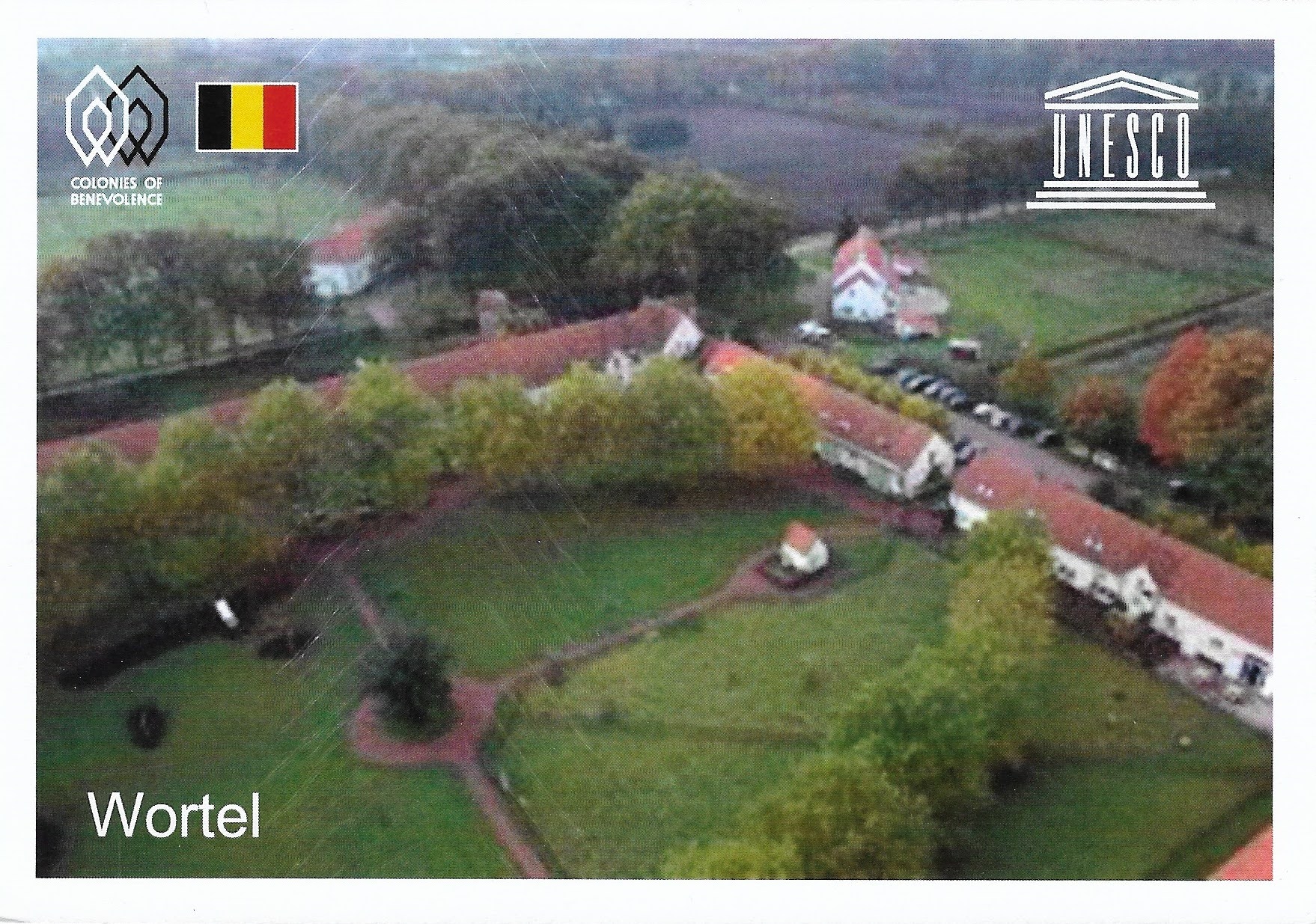
This factory in Rotterdam  is considered a prime example of the International Style and one of the most beautiful factories in the world

Van Nellefabriek
This postcard was sent by Mike

Van Nellefabriek was designed and built in the 1920s on the banks of a canal in the Spaanse Polder industrial zone north-west of Rotterdam. 

Van Nellefabriek
This postcard was sent by Christa

The site is one of the icons of 20th-century industrial architecture, comprising a complex of factories, with façades consisting essentially of steel and glass, making large-scale use of the curtain wall principle. It was conceived as an ‘ideal factory’, open to the outside world, whose interior working spaces evolved according to need, and in which daylight was used to provide pleasant working conditions. - in: http://whc.unesco.org/en/list/1441

Saturday, 18 September 2021

Colonies of Benevolence

This sites encompasses four settlements, three in the Netherlands and one in Belgium


Wortel
This postcard was sent by Javier


Wortel is a village in the Belgian municipality of Hoogstraten. As of 2007, it has 1,844 inhabitants as of 2021.

The toponym means carrot or root in Dutch. Wortel was established in the early 19th century by the Society of Benevolence as a farming colony for the able-bodied working poor. It was meant to provide employment during a time when poverty rates were very high in the Low Countries. Along with the other colonies constructed by the Society of Benevolence, Wortel was inscribed on the UNESCO World Heritage List in 2021 as an excellent example of a unique method of housing reform and urban planning. - in: wikipedia


Dutch Colonies of Benevolence

This postcard was sent by Javier

The transnational serial property encompasses four settlements; cultural landscapes with one colony in Belgium and three in The Netherlands. Together they bear witness to a 19th century experiment in social reform, an effort to alleviate urban poverty by establishing agricultural colonies in remote locations. Established in 1818, Frederiksoord (the Netherlands) is the earliest of these colonies and home to the original headquarters of the Society of Benevolence, an association which aimed to reduce poverty at the national level. Other components of the property are the colonies of Wilhelminaoord and Veenhuizen, in the Netherlands, and Wortel in Belgium. - in: https://whc.unesco.org/en/list/1555/


Wilhelminaroord

This postcard was sent by Jarina


Wilhelminaoord is a village in the Dutch province of Drenthe. It is a part of the municipality of Westerveld, and lies about 26 km northwest of Hoogeveen.

Wilhelminaoord was one of the farming colonies established by the Society of Benevolence in the early 19th century to decrease poverty by providing sustainable employment for able-bodied poor people. Along with the other colonies constructed by the Society, it was inscribed on the UNESCO World Heritage List in 2021 because of its testimony to a unique method of housing reform and its urban planning. - in: wikipedia


Veenhuizen
This postcard was sent by Jarina

Veenhuizen is a village with around 800 inhabitants in the province of Drenthe in the Netherlands. In the early 19th century, a reform housing colony for the poor and homeless was established in Veenhuizen by the Society of Benevolence. In the late 19th century, the complex was turned into a penal colony. The village became freely accessible in 1984 and has been part of the municipality of Noordenveld since 1998. The National Prison Museum is located here. Along with other colonies established by the Society of Benevolence, Veenhuizen was inscribed on the UNESCO World Heritage List in 2021, for its testimony to a unique method of housing reform and its urban planning. - in: wikipedia

The colonies (in red what I have):

  • Wortel
  • Frederiksoord
  • Wilhelminaoord
  • Veenhuizen


Sunday, 1 August 2021

Frontiers of the Roman Empire – The Lower German Limes

This first postcard was one of the first postcards that I received through Postcrossing and I had no idea that was on the UNESCO list until I saw a postcard of Colonia Ulpia Traina (the same thing that says in my postcard) in the SL Liew's UNESCO Postcard blog. After confirmation of Marcel, another postcrosser who already sent me a few postcards and knows the site, voilá, new UNESCO in my collection! The others arrived to my mailbox after the inscription.


Hafentempel, Xanten
This postcard was sent by Carsta

Xanten is a town in the state of North Rhine-WestphaliaGermany
Xanten is known for the Archaeological Park, one of the largest archaeological open air museums in the world, built at the site of the Roman settlements Colonia Ulpia Traiana.
The Archäologischer Park Xanten is built on the site of the Roman town, and it is one of the most frequently visited parks in Germany. In 2012, the Archaeological Park was expanded to nearly the whole area of the Roman colonia after Bundesstraße 57 was moved away from the area. - in: wikipedia

Castra Herculis - Arnhem
This postcard was sent by Javier

The Lower Germanic Limes (Latinlimes ad Germaniam inferioremDutchNeder-Germaanse LimesGermanNiedergermanischer Limes) is the former frontier between the Roman province of Germania inferior and Germania Magna. The Lower Germanic Limes separated that part of the Rhineland left of the Rhine as well as the Netherlands, which was part of the Roman Empire, from the less tightly controlled regions east of the Rhine.
The Lower Germanic Limes was not a fortified limes with rampartsditchespalisades or walls and watchtowers, but a river border (Lat.: ripa), similarly to the limites on the Danube and Euphrates. The Rhine Line was guarded by a chain of castra for auxiliary troops. It was laid out partly by Augustus and his stepson and military commander, Drusus, who began to strengthen the natural boundary of the Rhine from the year 15 A. D. The decision not to conquer the regions east of the Rhine in 16 A. D. made the Rhine into a fixed frontier of the Roman Empire. For its protection, many estates (villae rusticae) and settlements (vici) were established. - in: wikipedia


Silver Helmet Strap found in Utrecht
This postcard was sent by Jeroen

Traiectum was a Roman fort, on the frontier of the Roman Empire in Germania Inferior. The remains of the fort are in the center of Utrecht, Netherlands, which takes its name from the fort.
In the Roman Empire Traiectum was one of the forts in the lower Limes Germanicus defensive lines. The Emperor Claudius defined the Rhine downstream from Bonn as the western part of the frontier. He ordered the legions further north to withdraw to this line, which was fortified in AD 47. The Rhine divides into several branches in the Netherlands. The army chose the branch on which modern Utrecht lies as the frontier. - in: wikipedia

Friday, 30 July 2021

Dutch Water Defence Lines

This year UNESCO added the New Dutch Water Line to the site Defence Line of Amsterdam. The Dutch Water Line was a series of water-based defences combined with natural bodies of water that could be used to transform Holland, the westernmost region of the Netherlands and adjacent to the North Sea, almost into an island. 


Fort Pampus
This postcard was sent by Kim

Pampus is an artificial island and late 19th-century sea fort located in the IJmeer near Amsterdam. It now belongs to the municipality of Gooise Meren and is open to visitors.
The fort is built of bricks and concrete. The fort has an oval shape and the main building has three floors. On the ground floor were the troops' quarters, kitchen, laundry, two coal-fired steam engines of 20 hp, two dynamos, telegraph, first aid station, and magazines. in: wikipedia


Loevestein Castle
This postcard was sent from Australia by Helen

Loevestein Castle (DutchSlot Loevestein) is a medieval castle in the municipality of ZaltbommelGelderland, the Netherlands.
The castle was built by the knight Dirc Loef van Horne (hence "Loef's stein" (stone) house) between 1357 and 1397. Until World War II Loevestein Castle was part of the Hollandic Water Line, the main Dutch defense line that was based on flooding an area of land south and east of the western provinces. Currently the castle is used as a medieval museum and function centre. - in: wikipedia

Saturday, 24 March 2018

Mill Network at Kinderdijk-Elshout

The windmills of Kinderdijk are one of the best-known Dutch tourist sites and I hope to go there one day.

Kinderdijk
This postcard was sent by Kim

The windmills at Kinderdijk are a group of 19 monumental windmills in the Alblasserwaard polder, in the province of South HollandNetherlands. Most of the mills are part of the village of Kinderdijk in the municipality of Molenwaard, and one mill, De Blokker, is part of the municipality of Alblasserdam. Built in 1738 and 1740, to keep water out of the polder, it is the largest concentration of old windmills in the Netherlands and one of the best-known Dutch tourist sites. The mills are listed as national monuments and the entire area is a protected village view since 1993. They have been a UNESCO World Heritage Site since 1997. 


Kinderdijk

This postcard was sent by Christel

Kinderdijk lies in the Alblasserwaard, at the confluence of the Lek and Noord rivers. In Alblasserwaard, problems with water became more and more apparent in the 13th century. Large canals, called "weteringen", were dug to get rid of the excess water in the polders. However, the drained soil started setting, while the level of the river rose due to the river's sand deposits. 

Kinderdijk

This postcard was sent by Diana

After a few centuries, an additional way to keep the polders dry was required. It was decided to build a series of windmills, with a limited capacity to bridge water level differences, but just able to pump water into a reservoir at an intermediate level between the soil in the polder and the river; the reservoir could be pumped out into the river by other windmills whenever the river level was low enough; the river level has both seasonal and tidal variations. Although some of the windmills are still used, the main water works are provided by two diesel pumping stations near one of the entrances of the windmills site.

Kinderdijk
This postcard was sent by Astrid

Most of the current mills were built in 1738 and 1740, and form two stairways of 8 mills each to pump water to a higher level every time it reaches the next mill in line. - in: wikipedia

Kinderdijk
This postcard was sent by Joyce


Saturday, 2 December 2017

Historic Area of Willemstad, Inner City and Harbour, Curaçao

This is a Dutch site, but is located in the Caribbean 

Willemstad Harbour
This postcard was sent by Moniek

The Historic Area of Willemstad is an example of a colonial trading and administrative settlement. It was established by the Dutch on the island of Curaçao, situated in the southern Caribbean, near the tip of South America.
The architecture of Willemstad has been influenced not only by Dutch colonial concepts but also by the tropical climate and architectural styles from towns throughout the Caribbean region, with which the settlement engaged in trade. The colourful buildings of Willemstad are a local tradition dating from 1817, when the previous style of white lime finish on a building exterior was prohibited, apparently to protect eyesight from the glare. Predominant colours are red, blue, yellow ochre and various shades of green. - in: http://whc.unesco.org/en/list/819/

Friday, 16 June 2017

Ir.D.F. Woudagemaal (D.F. Wouda Steam Pumping Station)

This is the largest still operational steam-powered pumping station in the world, built to prevent floods.

Ir.D.F. Woudagemaal
This postcard was sent by Saskia

The Wouda Pumping Station at Lemmer in the province of Friesland opened in 1920. It is the largest steam-pumping station ever built and is still in operation. It represents the high point of the contribution made by Netherlands engineers and architects in protecting their people and land against the natural forces of water. - in: http://whc.unesco.org/en/list/867

Seventeenth-Century Canal Ring Area of Amsterdam inside the Singelgracht

Amsterdam is one of the cities of my top 5 "must visit"

Keizersgracht Canal
This postcard was sent by Kim

Amsterdam, capital of the Netherlands, has more than one hundred kilometers of canals, about 90 islands and 1,500 bridges. The three main canals, HerengrachtPrinsengracht, and Keizersgracht, dug in the 17th century during the Dutch Golden Age, form concentric belts around the city, known as the Grachtengordel. Alongside the main canals are 1550 monumental buildings. - in: wikipedia

Amsterdam Canal

This postcard was sent by Trudy

Monday, 4 July 2016

Rietveld Schröderhuis (Rietveld Schröder House)

At first sight we might wonder why such an ordinary house is a UNESCO World Heritage Site, but when we know that this house was built in the 1920's we realize that was not that ordinary for its time

Rietveld Schröder House
This postcard was sent by Kim

The Rietveld Schröder House (DutchRietveld Schröderhuis) (also known as the Schröder House) in Utrecht was built in 1924 by Dutch architect Gerrit Rietveld for Mrs. Truus Schröder-Schräder and her three children.
She commissioned the house to be designed preferably without walls. Rietveld worked side by side with Schröder-Schräder to create the house. He sketched the first possible design for the building; Schröder-Schrader was not pleased. She envisioned a house that was free from association and could create a connection between the inside and outside. The house is one of the best known examples of De Stijl-architecture and arguably the only true De Stijl building. Mrs. Schröder lived in the house until her death in 1985. The house was restored by Bertus Mulder and now is a museum open for visits, run by the Centraal Museum. It is a listed monument since 1976 and UNESCO World Heritage Site since 2000. - in: wikipedia

Tuesday, 21 June 2016

Droogmakerij de Beemster (Beemster Polder)

Beemster Polder is one of the best examples of how to make land out of water

Beemster Polder
This postcard was sent by Moniek

The Beemster Polder is a cultural landscape located north of Amsterdam, dating from the early 17th century, and an exceptional example of reclaimed land in the Netherlands. It was created by the draining of Lake Beemster in 1612, in order to develop new agricultural land and space for country residences, and to combat flooding in this low-lying region. It also provided a means for capital investment in land. Other earlier land reclamation had taken place, but technical improvements in windmill technology permitted more ambitious undertakings. The Beemster Polder was the first large project covering an area of 7,208 hectares. Today it is a well-ordered agricultural landscape of fields, roads, canals, dykes and settlements. - in: http://whc.unesco.org/en/list/899

Sunday, 19 June 2016

Schokland and Surroundings

"God created the earth, but the Dutch created the Netherlands." This interesting saying represents well the struggle of the people of Schokland 

Schokland Church/Museum
This postcard was sent by Ischa

Schokland was a peninsula that by the 15th century had become an island. Occupied and then abandoned as the sea encroached, it had to be evacuated in 1859. But following the draining of the Zuider Zee, it has, since the 1940s, formed part of the land reclaimed from the sea. Schokland has vestiges of human habitation going back to prehistoric times. It symbolizes the heroic, age-old struggle of the people of the Netherlands against the encroachment of the waters. - in: http://whc.unesco.org/en/list/739

Thursday, 26 May 2016

Wadden Sea

In the Wadden Sea up to 6.1 million birds can be present at the same time. That's a lot of birds!

The Wadden Sea in Denmark
This postcard was sent by Rebekka

The Wadden Sea (DutchWaddenzeeGermanWattenmeerLow GermanWattensee or WaddenzeeDanish:VadehavetWest FrisianWaadseeNorth Frisiandi Heef) is an intertidal zone in the southeastern part of the North Sea. It lies between the coast of northwestern continental Europe and the range of Frisian Islands, forming a shallow body of water with tidal flats and wetlands. It is rich in biological diversity. In 2009, the Dutch and German parts of the Wadden Sea were inscribed on UNESCO's World Heritage List and the Danish part was added in June 2014. - in: wikipedia

The Wadden Sea in Germany
This postcard was sent by Michèle

The Wadden Sea is famous for its rich flora and fauna, especially birds. Hundreds of thousands of waders (shorebirds)ducks, and geese use the area as a migration stopover or wintering site, and it is also a rich habitat for gulls and terns. However, the biodiversity of Wadden Sea today is only a fraction of what was seen before exploitation by humans; for birds, larger species such as geese, eaglesflamingospelicans, and herons used to be common as well. Some species that are regionally extinct are still available here. - in: wikipedia

The Wadden Sea in Germany
This postcard was sent by Elisabeth and Lisa

The Wadden Sea is one of the world's seas whose coastline has been most modified by humans, via systems of dikes and causeways on the mainland and low-lying coastal islands. The Wadden Sea stretches from Den Helder in the Netherlands in the northwest, past the great river estuaries of Germany to its northern boundary at Skallingen north of Esbjerg in Denmark along a total length of some 500 km and a total area of about 10,000 km2. Within the Netherlands it is bounded from the IJsselmeer by the Afsluitdijk. - in: wikipedia

The Wadden Sea in the Netherlands
This postcard was sent by Kim

The word wad is Dutch for "mud flat" (Low German and GermanWattDanishVade). The area is typified by extensive tidal mud flats, deeper tidal trenches (tidal creeks) and the islands that are contained within this, a region continually contested by land and sea. The landscape has been formed for a great part by storm tides in the 10th to 14th centuries, overflowing and carrying away former peat land behind the coastal dunes. The present islands are a remnant of the former coastal dunes. - in: wikipedia

The Wadden Sea in the Netherlands
This postcard was sent by Jet

Although the Wadden Sea is not yet listed as a transboundary Ramsar site, a great part of the Wadden Sea is protected in cooperation of all three countries. The governments of the Netherlands, Denmark and Germany have been working together since 1978 on the protection and conservation of the Wadden Sea. - in: wikipedia