The landscapes of this UNESCO site of New Zealand can really take the breath away!
 |
| Mitre Peak, Fiorland National Park |

This postcard was sent by Stephanie
Mitre Peak (Māori Rahotu) is an iconic mountain in the South Island of New Zealand. It is one of the most photographed peaks in the country.
Part of the reason for its iconic status is its location. Close to the shore of Milford Sound, in the Fiordland National Park in the southwestern South Island, it is a stunning sight. The mountain rises near vertically to 5,560 feet (1,690 m), i.e. just over a mile, from the water of the sound; it is more technically a fjord. The peak is actually a closely grouped set of five peaks, although from most easily accessible viewpoints it appears as a single point. Milford Sound is part of Te Wahipounamu, a World Heritage Site as declared by UNESCO. - in: wikipedia
This postcard was sent by Jackie
 |
| Miilford Track |
The Milford Track is a widely known tramping (hiking) route in New Zealand – located amidst mountains and temperate rain forest in Fiordland National Park in the southwest of the South Island.
The 53.5 km hike starts at Glade Wharf at the head of Lake Te Anau and finishes in Milford Sound at Sandfly Point, traversing rainforests, wetlands, and an alpine pass. - in: wikipedia
This postcard was sent by Jackie
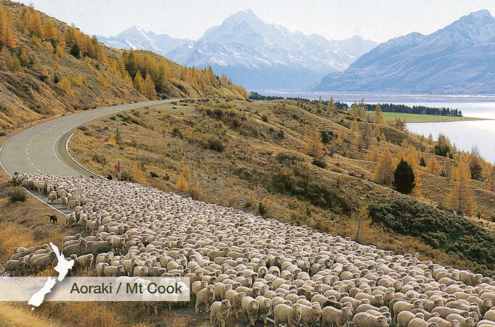 |
| Aoraki/Mount Cook |
Aoraki / Mount Cook is the highest mountain in New Zealand. Its height since 2014 is listed as 3,724 metres (12,218 feet), down from 3,764 m (12,349 ft) before December 1991, due to a rockslide and subsequent erosion. It lies in the Southern Alps, the mountain range which runs the length of the South Island. A popular tourist destination, it is also a favourite challenge for mountain climbers. Aoraki / Mount Cook consists of three summits, from South to North the Low Peak (3,593 m or 11,788 ft), Middle Peak (3,717 m or 12,195 ft) and High Peak. The summits lie slightly south and east of the main divide of the Southern Alps, with the Tasman Glacier to the east and the Hooker Glacier to the southwest. - in: wikipedia
 This postcard was sent from Germany by Jennifer
 |
| Mount Sefton |

Mount Sefton (Māori: Maukatua) is a mountain in the Aroarokaehe Range of the Southern Alps of New Zealand, just 12 kilometres (7.5 mi) south of Aoraki / Mount Cook. To the south lies Mount Brunner, and to the north The Footstool, both more than 400 metres (1,300 ft) shorter. - in: wikipedia


